Insurance Ready
4K Visual + Metadata to support claim processing and provide visual clarity for adjusters.
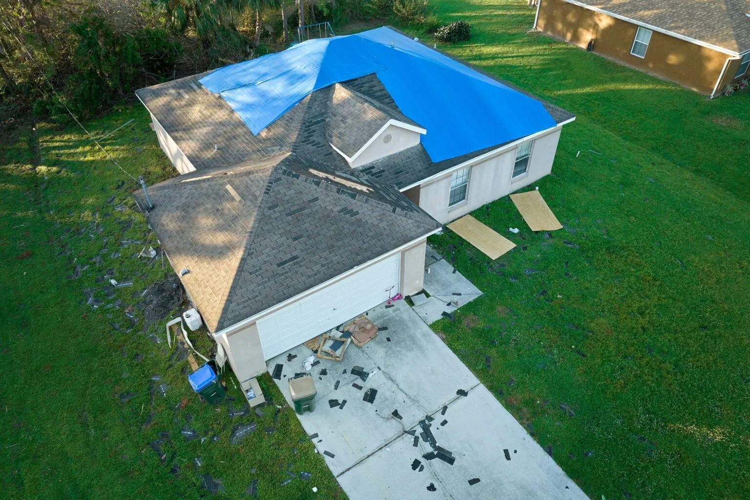
Storm Damage Documentation
After severe weather, documentation is your strongest asset. We provide homeowners and estate managers with high-resolution visual documentation of wind and hail impact.
High-Res Aerial Mapping
Zoom into individual shingles to identify micro-fractures and granular loss that ground-based inspections miss.
Post-Event Safety Scans
Identify loose debris, compromised chimneys, or structural hazards before sending contractors onto the roof.
Full Claim Support
Detailed PDF reports with GPS timestamps to satisfy the requirements of major insurance carriers.
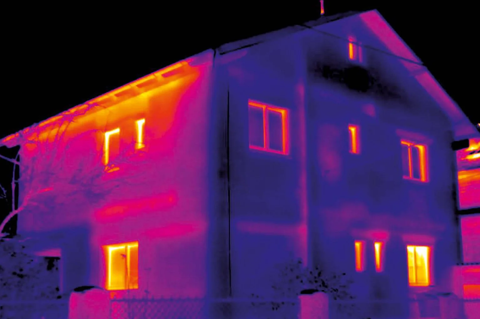
Residential Energy Loss Prevention
Stop heating the outdoors. Our thermal imaging reveals pinpoints thermal anomalies indicating where your home is losing expensive conditioned air through insulation gaps and structural leaks.
Insulation Deficiency Mapping
Identify "missing" or settled insulation within finished walls and attics without drilling holes.
HVAC & Air Leak Detection
Locate thermal bridges and air bypasses around windows, doors, and vent penetrations.
Utility Cost Reduction
Use our data to target repairs that offer the highest ROI on your monthly energy bills.
ENERGY LOSS MAPPING
Lower Energy BillsSignificant potential for efficiency gains through targeted remediation.
Estate Security Mapping
Ground-based cameras have fixed perspectives and blind spots. Our aerial thermal assessments provide a comprehensive overview of your property, identifying weaknesses in your perimeter before they can be exploited.
Perimeter Visibility Assessment
Detect "shorts" in electrified fencing, structural gaps in gates, or compromised treelines where intruders could gain entry in 0% visibility.
Surveillance "Dead Zone" Identification
A comprehensive audit of your existing CCTV coverage, identifying hidden dips in terrain or foliage that mask movement from ground sensors.
Night Visibility
Visualize your estate through the eyes of a thermal sensor to verify that your lighting and security protocols provide 360-degree protection.
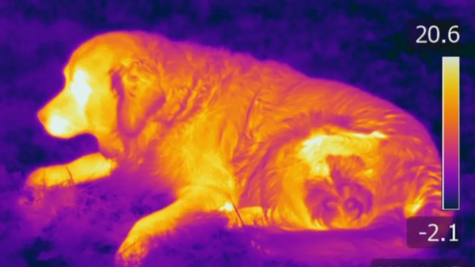
Missing Livestock & Pet Recovery
When a beloved pet or valuable livestock goes missing, every minute counts. Our thermal drones penetrate dense foliage and darkness to locate heat signatures quickly and safely.
Night & Day Search Capabilities
Locate lost animals in complete darkness, dense brush, or even areas inaccessible by foot, significantly reducing search times.
Precision Location Data
Pinpoint the GPS coordinates of your animal's heat signature, guiding ground teams directly to their location.
Safe & Non-Intrusive
Conduct wide-area searches without causing additional stress or startling a frightened animal, minimizing risk to both pet and personnel.
Ready to secure your property?
Whether you need rapid storm damage support or a complete estate security overview, our team is ready to provide the unseen data you need.