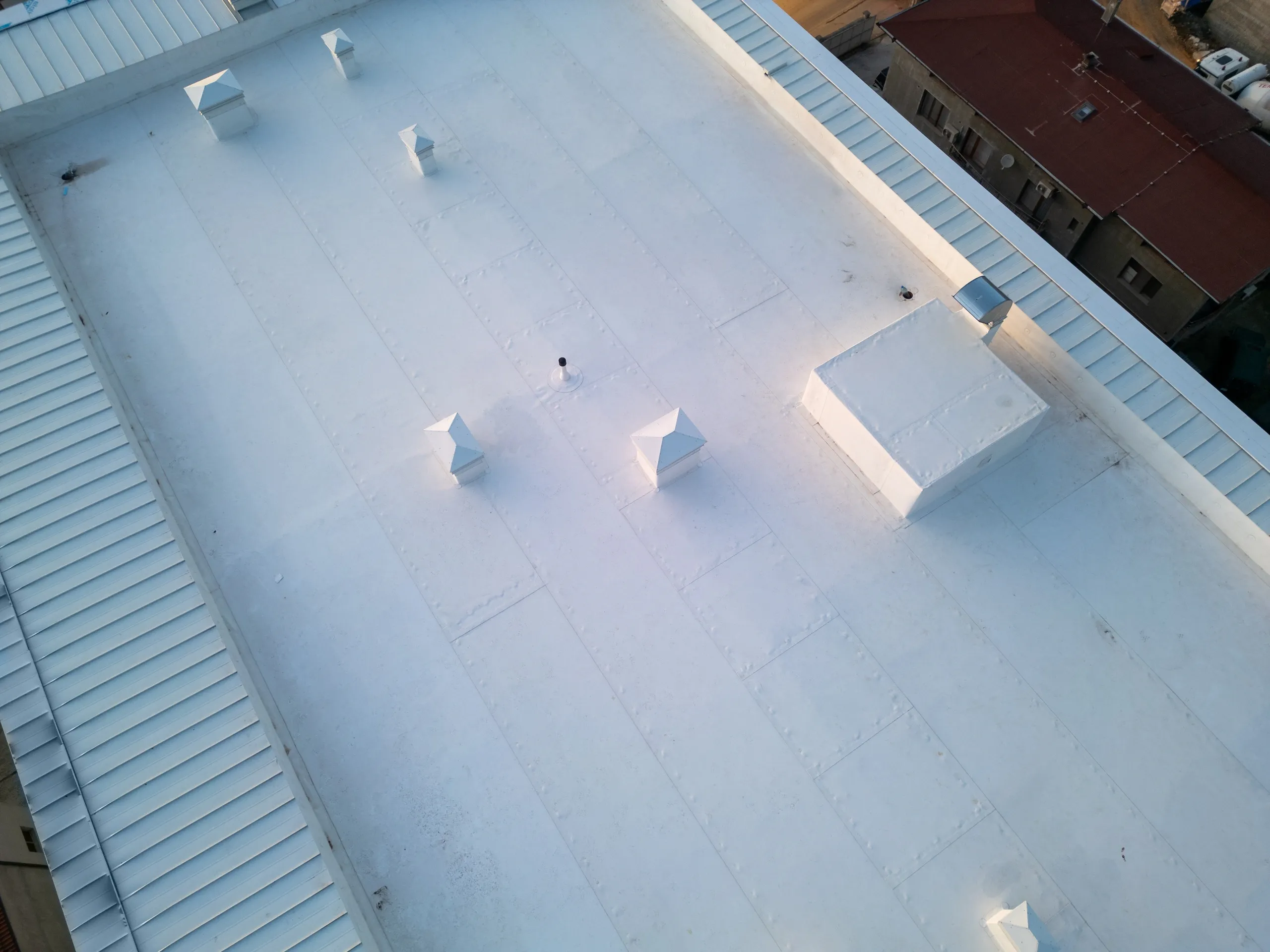
Flat Roof Moisture Scans
Professional-grade thermal imaging to identify sub-surface moisture anomalies.
Non-Destructive Leak Mapping
Identify areas of potential moisture entrapment within insulation layers without the need for invasive core samples.
Transient Window Specialists
Our pilots execute missions during the critical thermal "crossover" period to ensure high-fidelity radiometric data collection.
ASTM Standards Compliance
Every report is generated to meet ASTM C1153 standards for commercial roof moisture surveys.
ROI Advantage
Identifying a leak early can save up to 70% in maintenance costs compared to a full deck replacement.
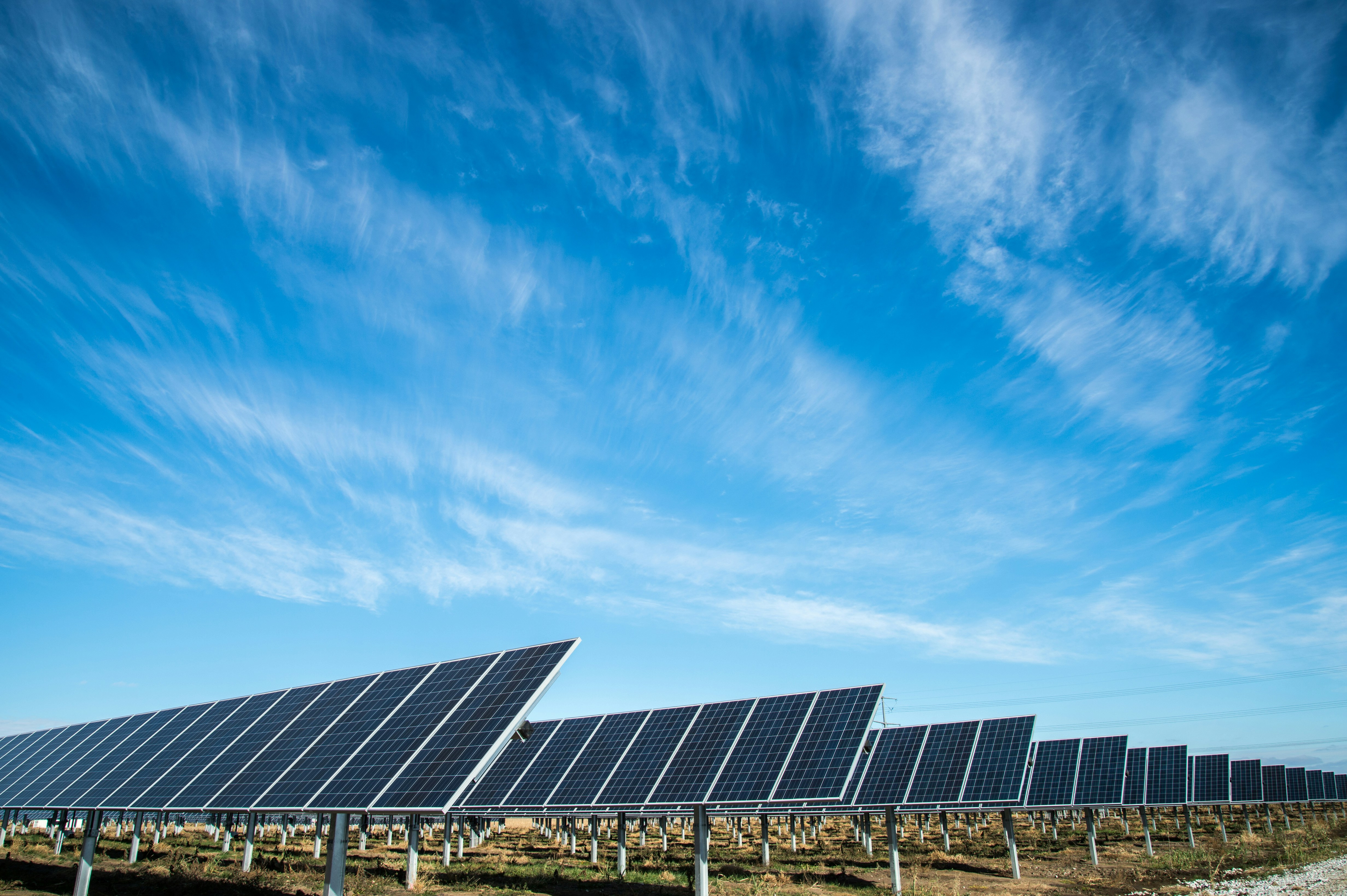
String Efficiency
100% Non-ContactDetect bypass diode failures and cell hotspots in seconds.
Solar Array Auditing
Maximize your energy harvest. We provide high-throughput aerial inspections for residential and commercial-scale solar assets.
Hotspot Identification
Identify individual cell failures that cause resistive heating to assist in risk mitigation and equipment maintenance.
String & Inverter Diagnostics
Detect entire string outages or sub-optimal inverter performance across complex arrays.
IEC 62446-3 Standards
Our thermal data collection meets international standards for the outdoor infrared thermography of photovoltaic modules.
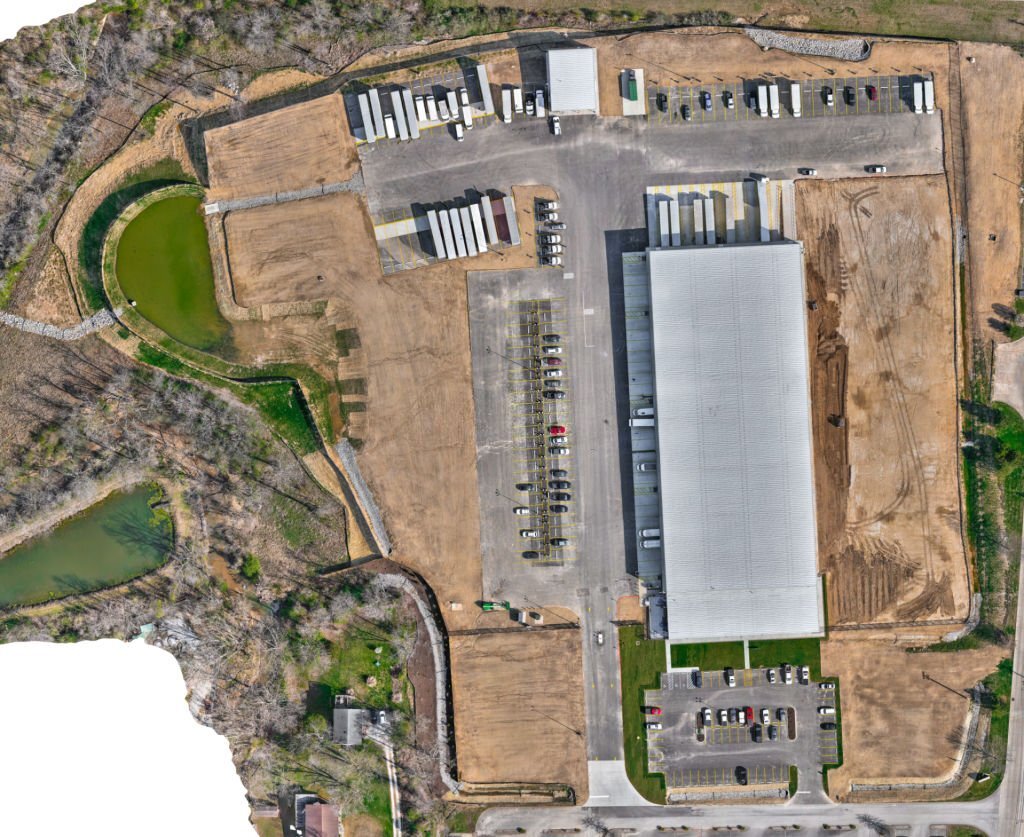
Construction Progress Tracking
High-resolution visual intelligence for project stakeholders. We provide the "eye in the sky" for site inspections and timeline verification.
Orthomosaic Mapping
Stitched high-res imagery creating a georeferenced "map" of your entire job site for visual spatial context and progress monitoring.
Weekly Progress Overviews
Repeatable flight paths ensure consistent "before and after" data for stakeholder reporting.
Safety & Compliance Scans
Identify site hazards and structural anomalies from a safe distance without halting ground operations.
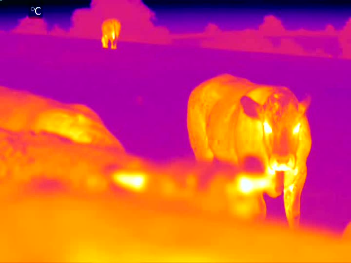
Agriculture & Animal Recovery
Thermal technology isn't just for buildings. We help Virginia farmers and estate owners protect their livestock and manage land more effectively.
Missing Livestock Recovery
Locate cattle, horses, or pets through dense brush or forest canopies using high-sensitivity thermal signatures.
Boundary & Fence Audits
Rapidly inspect miles of fencing and perimeter security from the air, identifying breaches or maintenance needs.
Irrigation & Crop Health
Detect irrigation leaks and moisture stress in crops before visual symptoms appear on the ground.
Technical Data Deliverables
We provide more than just images; we deliver professional radiometric data and georeferenced maps compatible with industry-standard software, providing the thermal insights required for informed decision-making.
Radiometric Analysis
Comprehensive thermal audits featuring high-res imagery, temperature data points, and anomaly severity indicators.
- ASTM C1153 Standards
- Delta-T Calculations
Orthomosaic Mapping
Explore your entire site in high resolution. Our georeferenced maps allow for precise measurements and 3D terrain modeling.
- GIS/CAD Integration
Raw Radiometric Datasets
For engineering firms that require the raw files. We provide full R-JPEG or TIFF datasets containing metadata for every pixel.
- FLIR/Autel Compatible
- Full Metadata Export
Frequently Asked Questions
Everything you need to know about our thermal drone operations and data delivery.
Work smarter, not harder.
Stop guessing and start seeing. Whether it's finding a leak in a commercial roof or pinpointing solar panel issues, we give you the clear view you need to fix problems fast.